Sunday 27 November 2011

Lathkill Dale & Mandale Mine Sough

Hi all, we had a lie in this week and set off at 7:30 but it was still dark and raining.
There were only 3 of us today, Geoff had family commitment's and was away for the weekend.
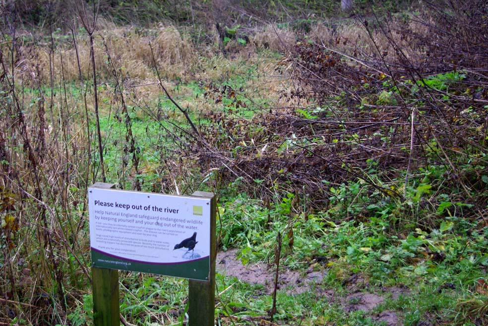
On last weeks Countryfile tv show they mentioned how the river in Lathkill Dale had dried up and so we thought we would go and have a look.
We parked up in the layby just above the medieval Conksbury Bridge, this bridge served the Turnpike from Newhaven to Grindleford and was also a sheepwash until the end of WW2.
We set off along a nice flat track alongside the river Lathkill.
Rob & Ike in wet weather gear.


River Lathkill in full flow
We walked up towards the Lathkill Lodge and the water had gone before we got there.
There is a section of the river that dries up every year but this year its much worse than normal. The latest theory assumes there has been some sort of breach from the soughs to join up with the Magpie mine sough and then down to the river Wye.
What river???
 We arrived at the remains of the 15th century corn mill & fishing lodge to find no sign of any water and the river bed was completely dry.
That's me stood in the middle of the river Lathkill

Clapper Bridge over the dry river bed.

Nice brace of pheasants
We pressed on towards "Batemans House" and on the way we passed by the remains of the old Mandale Mine pumphouse. This mine has been worked since the 13th century and didn't finish until 1851. 200 years ago this lead mine and surrounding area was like the equivalent to our modern Trading Estates, it would have been a hive of activity. The pumphouse housed a giant waterwheel which was the largest known to be used in mining history.
You can just see the remains of the pumphouse through the trees.
We carried on and saw the exit to Mandale Mine sough was clear of water, so we decided to investigate.
A sough is the passage where the drainage water from the mine flows to join the river.
Some of these soughs can be miles long and cut through solid rock. They often took years to construct but the benefits to miners were enormous. The soughs were part of a system where the water was drawn up with large pumps from below the mine workings and this would ensure dry conditions for miners to extract the lead ore.
Rob & Ike on top of the sough

Exit of the Mandale sough

Inside the sough

From inside looking out.
After having a stomp around inside the sough we decided we might go back next week with some torches. We pressed on to "Batemans House" to have a look around there.
Remains of Batemans House

Footbridge over the Lathkill river to Batemans House
This was constructed in 2004 by Natural England.

Rob & Ike going down to the see one of the shafts.

Shaft viewing level.
The house was built over a very deep mine shaft sometime in the 1840's for Thomas Bateman who was agent of the Lathkill Mine, he lived there with his family.
The remains have been made secure by Natural England so visitors can safely have a look around.
When you descend the access ladder to the shaft viewing level there is a hand crank which generates electricity to power some display lights.
We left Batemans House and headed back to the corn mill where we saw a dry area to stop and have breakfast.
Ike heading for the chuck wagon

Well it was dry and out of the wind.

Spotted this little beaut sitting on a wall.
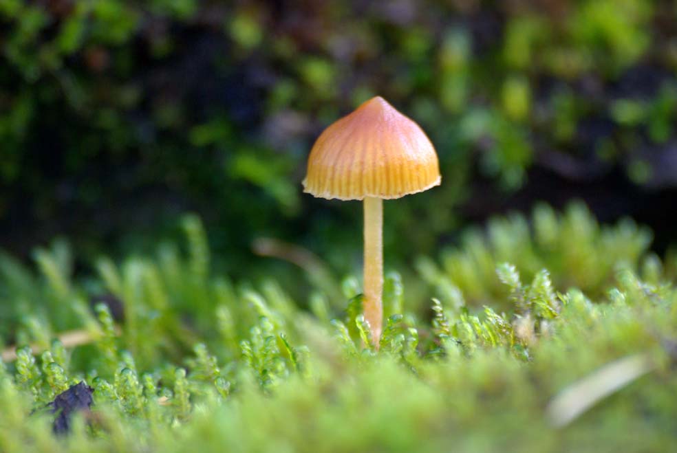
After brekki it was out of the chuck wagon and back off to the car. The sun started to come through and made the walk back a lot more comfortable. I spotted a little fungi of some sort on a wall amongst some moss, it was only about an inch high.
A last note in 1854 there was a section of the river where gold fever took hold. A mine was started and shares were sold for £1 each and quickly zoomed to £30 each and then they found out it was only Fools Gold, the mine was closed as quick as it opened. No doubt somebody made a profit!!
A trek back to the car and off home.
Cheers
see you next week.


Sunday 20 November 2011

Hope Church & Darley Dale

The mist was bad again this week and it was only 7 degree's when we set off for St. Peters Church in Hope.
The mist was still swirling around when we got to Hope, parked up Hope market place which is about the size of 6 cars. The yew avenue through the church yard was impressive and it led us straight to the stoop.
The stoop was found in 2000 and was erected in the church yard in 2003 by the Hope Historical Society.
The stoops new position since 2003

The wording is well worn and showing evidence of it being used as a gate post

Saxon cross & stoop

Very impressive Saxon Cross

The Church is famous for its Gargoyles.

Another fine structure in the Church grounds.
We had a general wander about Hope pokeing in here and there to see what we could find. People walk along the main road and many dont realise the old village stocks are builtinto the wall that runs in front of the church notice board. Admitted they are not obvious until they are pointed out.
 The remains of the stocks are at pavement level just between the small services markers.
St. Peters Church, Hope
We had a wander down the lane adjacent to the church and found an old Pinfold.
Geoff reading the rules for the Pinfold.
 A Pinfold was used to keep any stray animals under control until their owners paid for there return or they were sold on at market.
The old school on School Lane.
Another old letterbox King George V 1910 - 1936
We found another letterbox with GR markings on it. Hands up all that spotted the difference between this one and last weeks. Last weeks GR was in a decorative font with V1 intermingled in the GR which is obviously King George V1.

From Hope we made our way towards Darley Dale and stopped for breakfast in a layby next to a park.
We chatted to a couple of fly fishermen on there way to the river. Rob had met one of these guys before he owns a fishing tackle shop in Bakewell. They are part of a fishing syndicate and told us this was the only area in the UK where rainbow trout breed naturally. I had a lesson in fly tieing and it was all very interesting. Thanks a lot guys.
I hope they had a good catch
After breakfast we went in search of the elusive Darley Dale stoop, which by deduction we eventually found.
This stoop (E20) has been moved from its original position some time ago.

The lads at stoop E20
I spotted a nice old hand pump in a field complete with a set of stone steps. Presumably the outlet was high enough to fit some sort of wheeled container underneath while the operator furiously cranked the handle to draw the water up from the well.
Stairway to waterworld.
On the way home we stopped off at The Square & Compass an old inn on the boundary between South & North Darley.
You can just see the date on the lintol 1735
The Square & Compass

Boundary Stone
After the Square & Compass it was off home for some lunch.
Cheers see you next week


Monday 14 November 2011

Shillito Woods & Grindleford

It was a trip up to the woods today but not a teddy bears picnic!
We travelled north up the A6 through Chatsworth Park and right at Baslow onto the A621 towards our first stoop E9 on Fox Lane. It was very misty on the journey especially when we reached the higher ground. This stoop is in a small wood and the ground was quite boggy. Although not ideal for photo's the mist gave a lovely atmospheric feel to the place. The tree's in the wood were Alder and they thrive in damp conditions.
Stoop E9 in the middle of an Alder Wood.


Don't forget 300 years ago there would have been no trees here.

Companion Stone nearby to the stoop.

The stoop can be seen in the back ground
We went just about half a mile up the road and parked on the grass verge. Although it was only a couple of hundred yards off the road we couldn't see whats left of Fox Lane Cross because of the mist.
Fox Lane Cross.
Geoff has been here before and he tells us the views are stunning, well you can't win them all.
We got back in the car and drove back the way we came to Shillito Woods and pulled into the car park there.
The cross on Fox Lane and this cross in Shillito Woods were probably erected by Monks from Beauchief Abbey in the 13th century to help travellers. These ancient crosses were supplemented with stoops along the packhorse routes to guide travellers on there way.
Path through Shillito Wood

Shillito Cross


Shillito Cross
From Shillito Woods we went down towards Curbar Gap and stopped at the car park next to stoop E7 for our breakfast. It was still misty and damp so we sat in the car for our breakfast.
The information board at Curbar Gap.
After breakfast we moved on to Goatscliff near Grindleford to see stoop W1, this is in a private garden and when we arrived we knocked on the door of the owners.
A lady opened the door and said it was OK to take a look around. She took a bit of interest when Geoff showed her the book with the drawing of her stoop. The stoop was covered with a large fern which we gently pulled to one side for pictures.
Stoop W1
 This stoop is unusual with the direction to Bakewell being written backwards.
The stoop is next to a very old gate with individual members hand made from branches of an oak tree.
Stoop and Oak gate.

Ike giving scale to the size of the stoop.
Walking down the track back to the car we spotted these sculptures of rams in a cottage garden.
Wooden rams, at least they don't need feeding.

The boys strolling down Goatscliff Farm lane.

A "GR" letter box at the bottom of the lane.
The letter box at the bottom of Goatscliff Lane is a Wall Type manufactured by WT Allen & Co of London. The GR is the royal cypher for King George V1 1936 - 1952.

After Goatscliff we headed home with a stop at Rowsley Bridge, i wanted to see the boundary marker which was in the middle of the bridge.
If you look carefully at the photo you will see they even changed the style of the coping stones at the boundary. They certainly wanted to be different.
Rowsley Bridge boundary marker
Did you see RAMBO at Curbar, i bet you never knew that rabbits can climb trees!!!

 Cheers